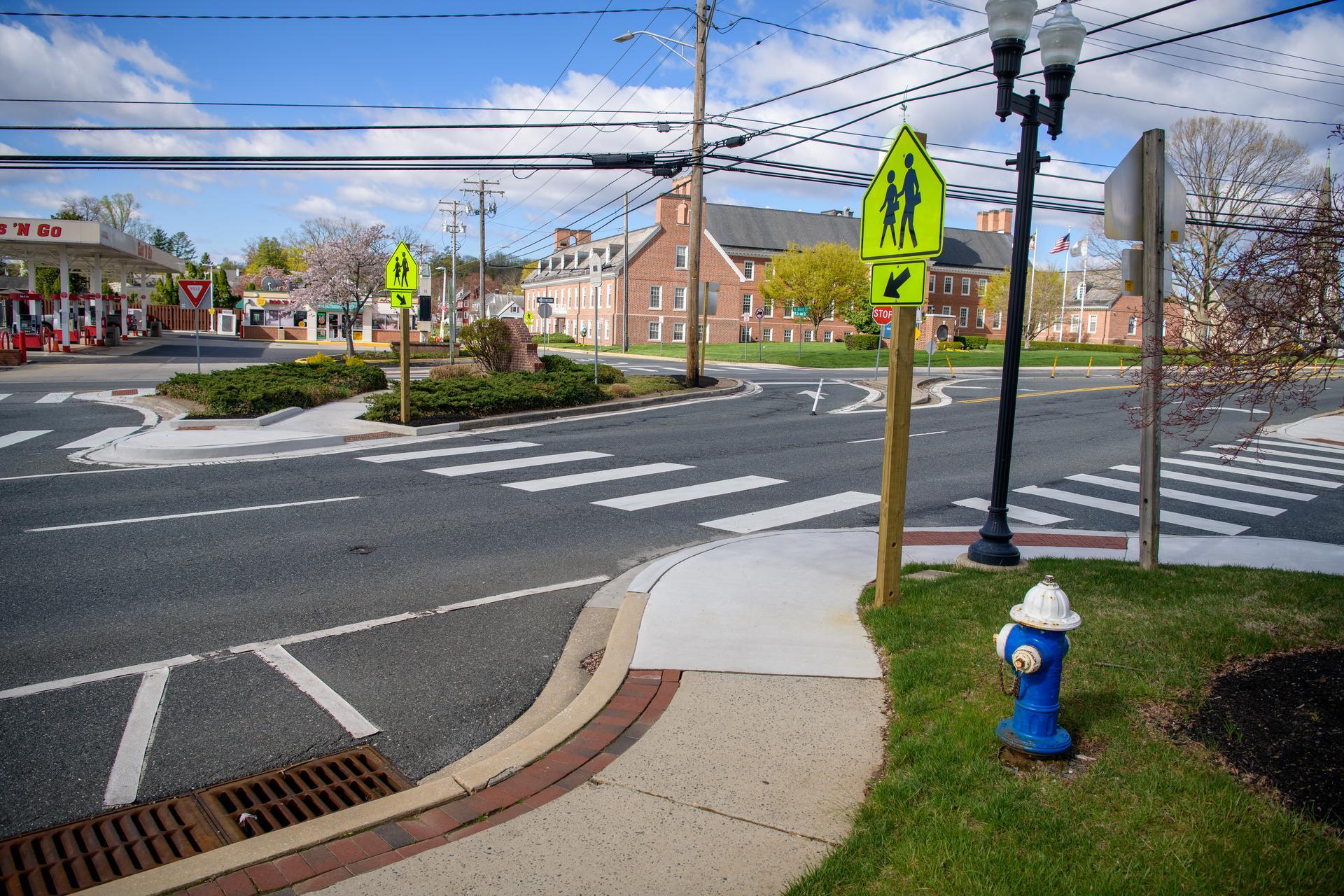
A complete street with sidewalks and crosswalks at the intersection of Main St., Bond St., and E. Gordon St. in Bel Air, Maryland. (MDOT/David Trozzo)
Whether you’re walking to school, heading to a bus stop, or just taking the dog for a stroll, sidewalks are a part of daily life. But have you ever wondered who keeps track of where those sidewalks go? For a long time in Maryland, the answer was no one. Because different cities and towns built their own paths over many years, there wasn’t one master map. This made it hard for planners to see where paths suddenly ended or where a new sidewalk was needed most.
One Map to Rule Them All
To fix the “missing map” problem, the Maryland Department of Transportation launched the Maryland Sidewalk Data Initiative. This project is part of a program called “One Maryland One Centerline” (OMOC).
The goal is simple but ambitious: create one reliable, digital map that shows every sidewalk in the state. By March 2026, the team reached a major milestone by documenting all sidewalks maintained by the state. That worked out to be 8,200 miles of sidewalks. To give you an idea of how much ground that covers, 8,200 miles is nearly half the length of all the state’s highways and toll roads combined!
Why Does a Sidewalk Map Matter?
You might think, “It’s just a sidewalk, why do we need a fancy database for it?” Well, having this data in one place helps the state make better decisions. A complete map helps planners:
- Improve Safety: They can see where pedestrians are walking and where they might need more protection.
- Fix Gaps: Have you ever been on a sidewalk that just… stops? This map helps the state find those “missing links” and connect them.
- Help Everyone: It makes it easier to plan for people with disabilities, ensuring that ramps and paths meet the rules of the Americans with Disabilities Act.
- Get Funding: When the state applies for money to build new things, having clear data makes the case much stronger.
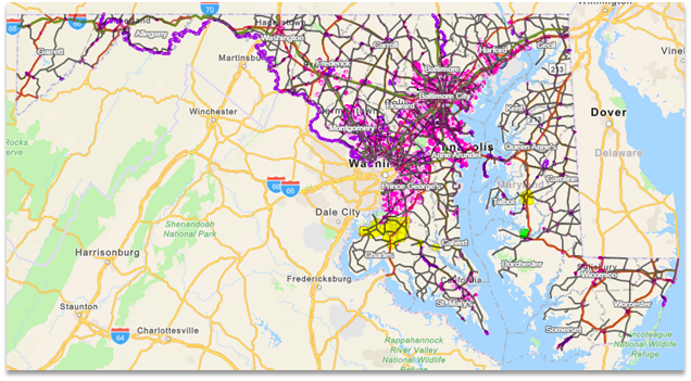
A map of all the sidewalk data collected so far.
Charles County Leads the Pack
While the whole state is working on this, Charles County has become a local superstar. The county was the first to finish “Tier One” of the project. This means they’ve verified exactly where their sidewalks are and where they connect.
Markus Tarjamo, a planner for Charles County, says that before this project, they didn’t have a full picture of how people moved around their rural and suburban neighborhoods. Now, they have a “comprehensive dataset” that helps them prioritize new projects. They are even adding information about where people cross the street.
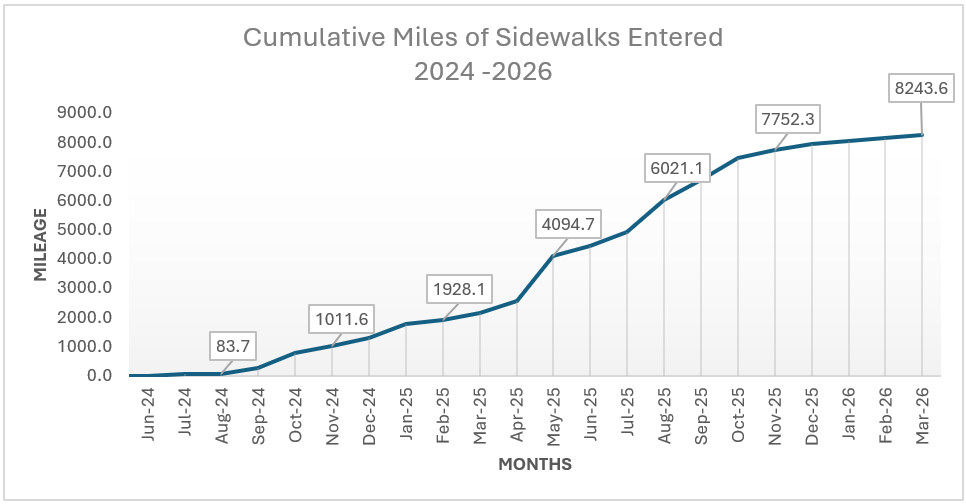
Cumulative miles of sidewalks entered from July 2024 through January 2026.
What’s Next?
The project isn’t finished yet. Now that the main lines are on the map, the focus is shifting to quality control. Experts are double-checking the data to make sure it’s accurate and working with local counties to fill in any tiny gaps that remain.
Maryland is one of the first states to try something this big. By putting every sidewalk on the map, the state is making sure our communities are safer, more connected and easier for everyone to navigate—one step at a time. For more information about the Maryland Sidewalk Data Collaboration, visit the project’s website.
Nasim Samadi is an intern with the Maryland Department of Transportation.